


1
2
3
4
5
6
7
8
9
10
11
12
13
14
15
16
17
Orthographic
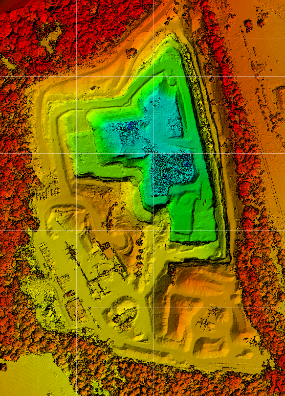
DEM
Contour line
Contour line generation of terrain. This can be overlay onto DEM or Ortho imagery and 3d modelling.
High Resolution aerial imagery
RPAS Australia on average achieves 5 cm/pixel resolution. Whereas Google Earth (TM) is about 50 cm/pixel. TEN TIMES sharper with our RPA's.
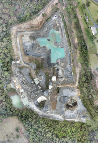
Quarry operations
Establishing shots for large operations. For use in publications & websites.
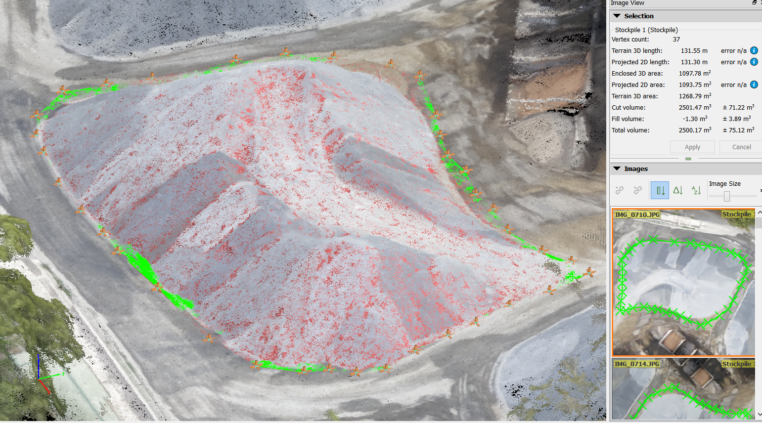
Volume Calculations
Quickly and accurately calculate the volume of stockplies, and cut & fill.
Quarry & mine operations
Reverting Acid-sulphate affected areas back to swamp status...110 years later.
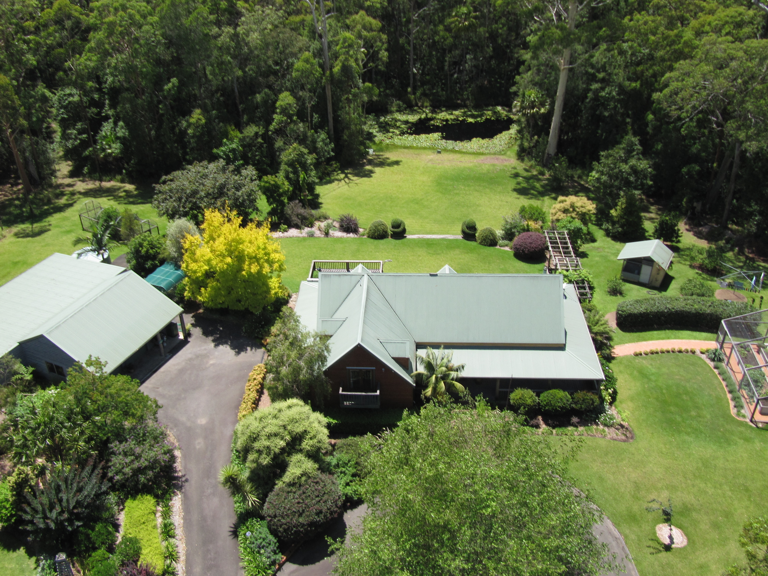
Real Estate
Perfect for those larger properties where a normal shot fails to tell the whole story.
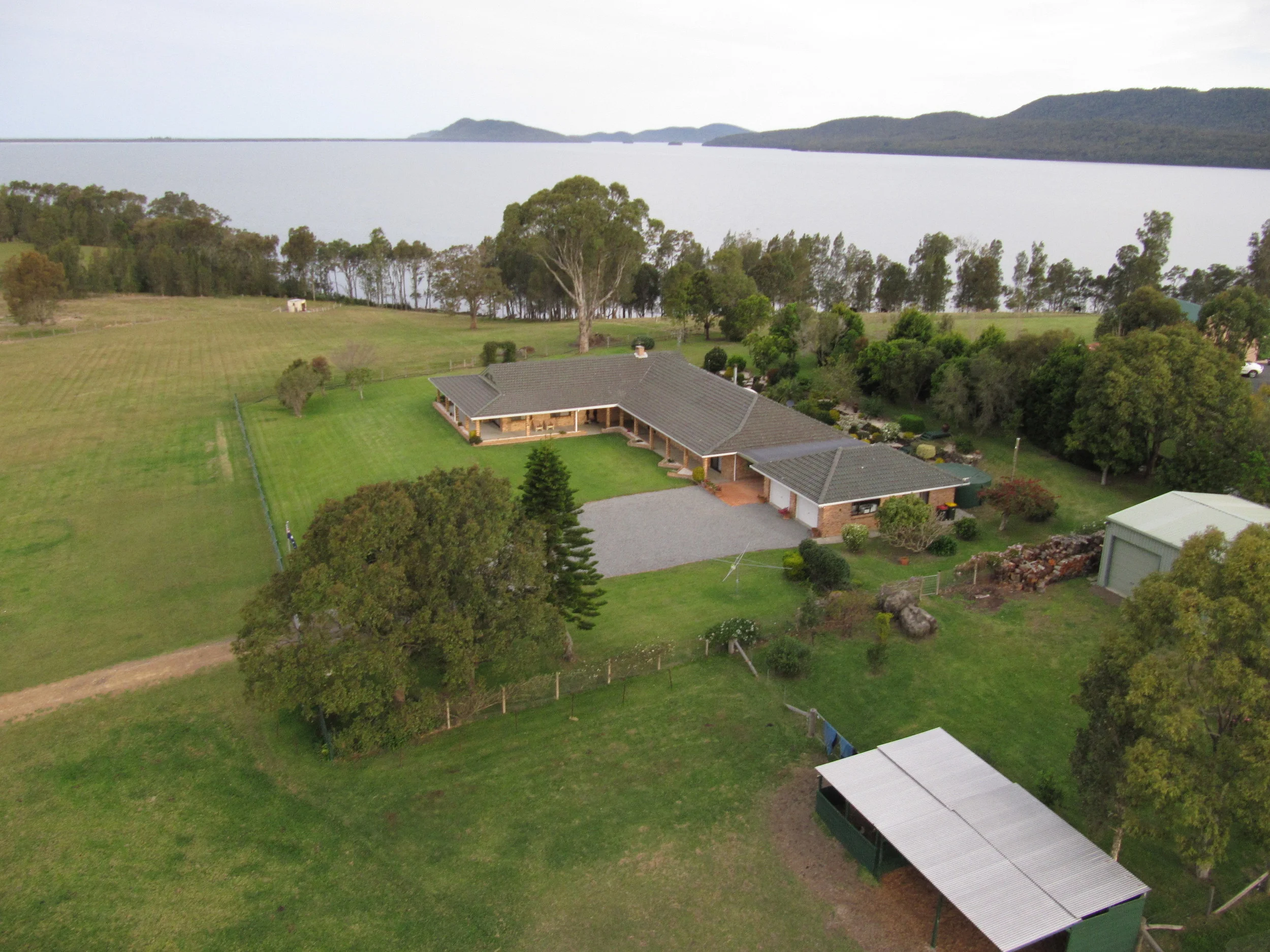
Rural properties
Some larger properties just cannot be adequately captured from the ground. This one for instance is situated on a small rise in the land and the lake is behind (below). To shoot from the front of the house meant the lake would not be in the narrative. Problem solved, story told, tell it from above.
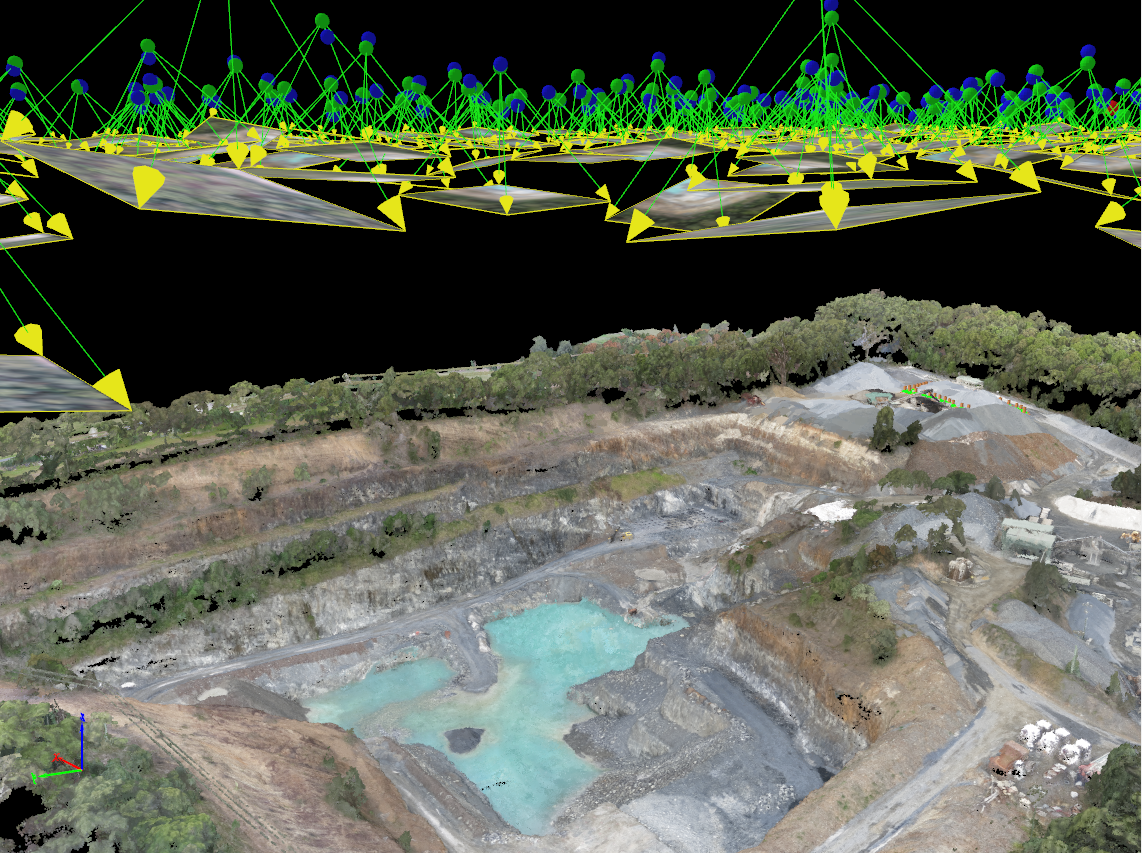
3D Point Clouds
3D Point Cloud generation outputs: DEM, stockpile calulaction, Cut & Fill volumes, 3D modelling and visualisation.
Quarry
The multirotor is great for those company promotional images that show the businesses operation.
Red Edge spectrum - Vegetation mapping (Index colour)
Using Red Edge Position sensors we can filter the Red Edge of the colour spectrum. This narrow frequency is a strong indicator of vegetation Chlorophyll (nir reflector) content and subsequent Nitrogen status... Plant health or stress indicator.
Google Earth -v- RPAS Australia
RPAS Australia aerial imagery easily imports to Google Earth. This provides you with a high resolution overlay to your Area of Interest.
RPAS Australia Uses the latest UAV / Drone technology to captures high resolution aerial imagery. For all your aerial imagery, mapping surveys, inspection, GIS mapping data needs.