

RPAS Australia was advocating for drones on Quarry sites years before they landed. It is hard to believe it was a ‘hard sell’ back then as it is no ubiquitous. Drones are the 'go to' method for mine site survey mapping, planning and monitoring. RPAS Australia has been in this space from the start.
RPAS Australia can deliver an aerial mapping photogrammetry data suite often within a day of data capture. Manned flights or ground surveys often take weeks of scheduling and often longer to get the information back. We get the data to you fast so you can make qualified decision fast and with confidence.
Mine planners can utilise our deliverables to produce:
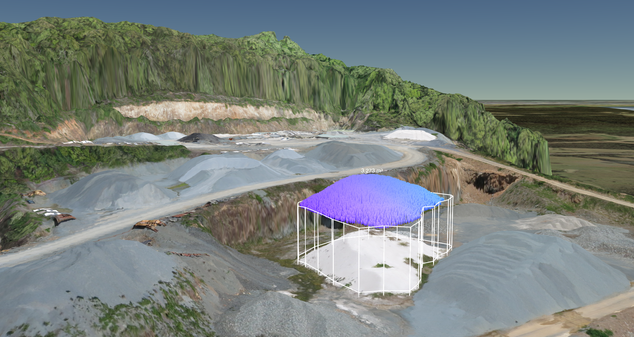
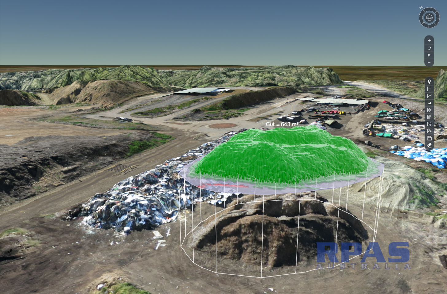
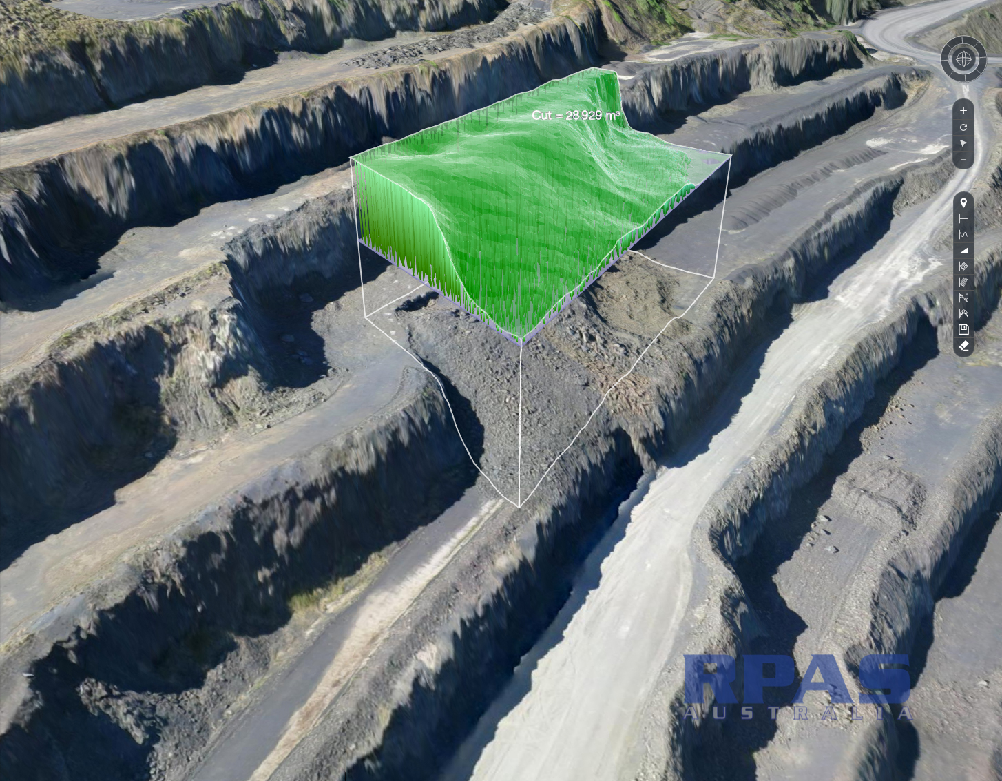
Accurate audits of stockpiles
Calculate blast yields
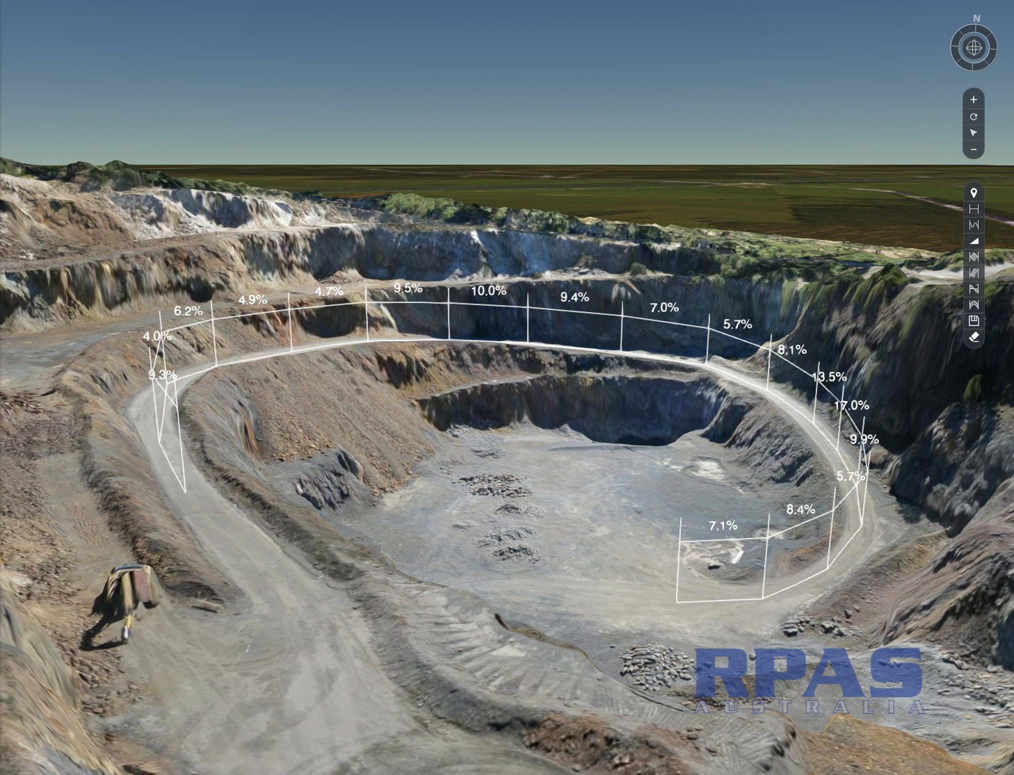
Develop compliant traffic management plans
Design rehabilitation and demonstrate compliance.
Managers find endless use cases for visually communicating the site to employees, blast crews and contractors.
The deliverables and use cases include:
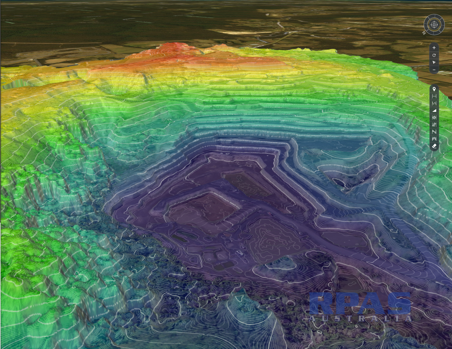
DTM's , DEM's
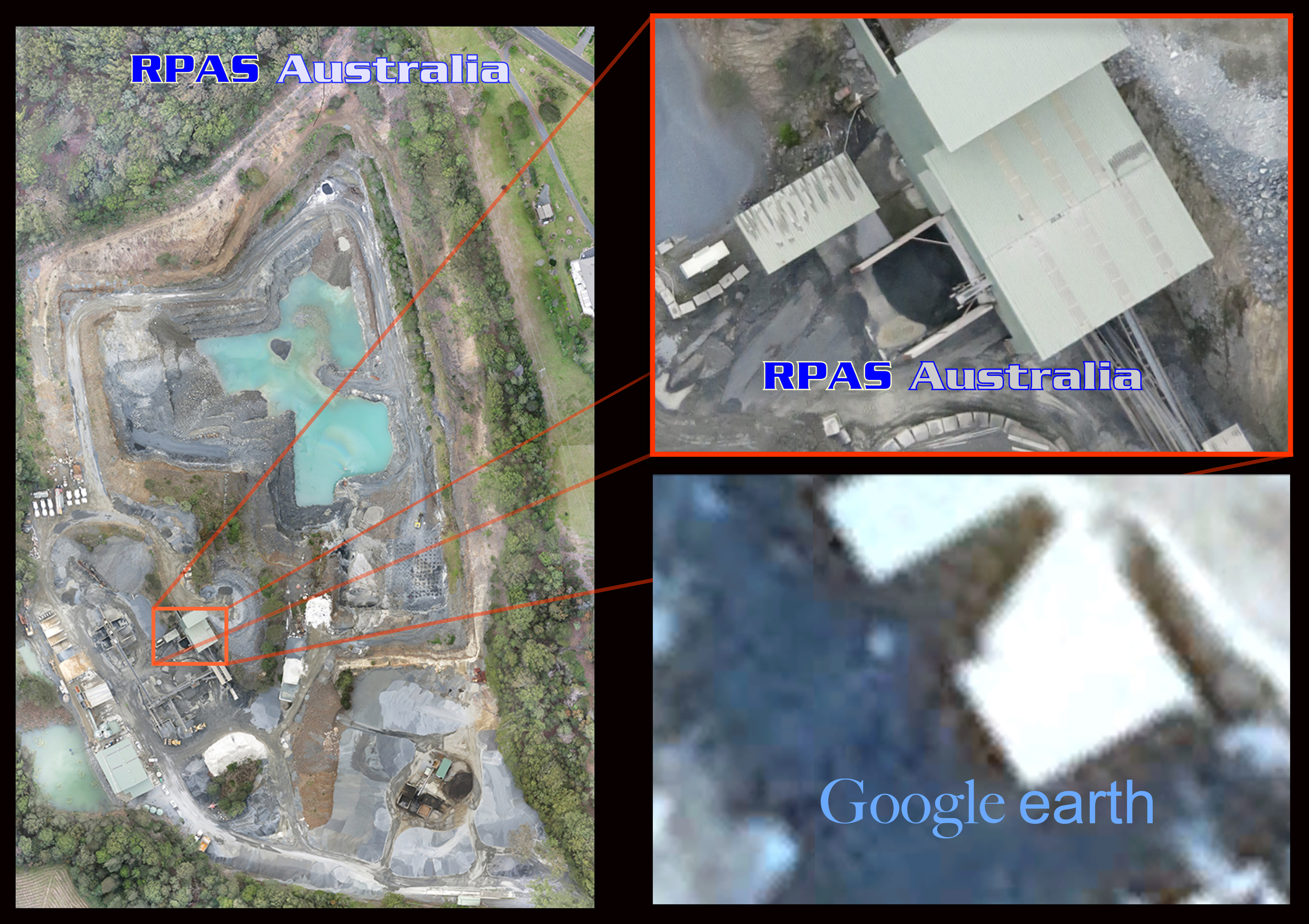
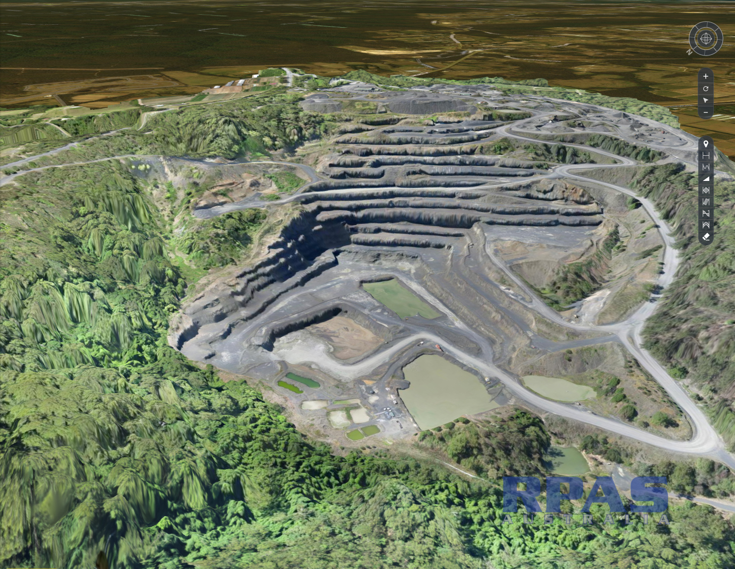
Survey grade Georectified orthographic imagery at resolutions averaging 3-5cm per pixel! - a credit card.
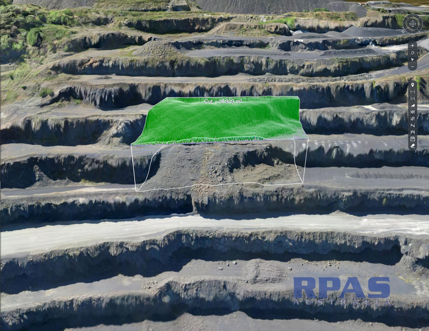
Contour lines, gradients, area calcs & Triangle mesh (3d Dxf files)
Volumetric calculations of stockpiles, cut and fill requirements
Site lines & radio transmission.
Vegetation rehabilitation assessment and auditing
3D models and fly-through animations

When you need to get a handle on what resources you have

Letting the public know what is going on saves a lot of pain


